Overview
Geotrackr is a geospatial platform I architected for Union Pacific Railroad — one of America's largest freight railroads — to track rail assets in real time across a 32,000-mile network. It turns a sprawling, hard-to-see system into a single live map: where assets are, and what's moving, at a glance. The result is logistical transparency the railroad didn't have before.
At its heart is geofencing. Teams draw zones around the places that matter — terminals, subdivisions, track segments — and Geotrackr watches assets move in and out of them in real time. Fences are grouped into sets by domain — train moves, train creation, terminal changes — each one owned, dated, and versioned, so the people responsible for a part of the network define exactly the visibility they need.
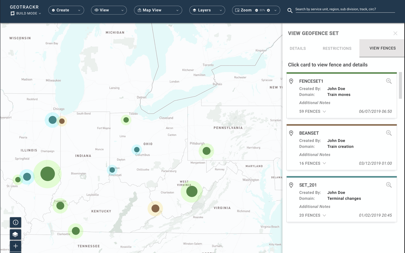
Geotrackr — a live map of the network, with geofence sets grouped by domain and ready to drill into.
The Problem
A network is only as manageable as it is visible. Before Geotrackr, Union Pacific had no live, spatial way to see where assets were or track how they moved across its 32,000-mile system. Logistical decisions were made without a real-time map.
There was also no self-serve way for teams to define the zones and events they cared about. The people closest to a terminal or a subdivision couldn't set up the visibility they needed on their own — so the network's most useful knowledge stayed locked out of the tools meant to surface it.
The Process
We built Geotrackr through two quick-turn design sprints, running the full sprint playbook each time — aligning on the problem, sketching divergent directions, deciding as a group, prototyping, and validating with the people who would use it. The compressed format kept the work honest: every decision had to earn its place against the clock, and each sprint ended with a concrete, tested direction rather than a pile of open questions.
The Design
The interface leads with the map — the network and its live asset activity, immediately — and puts the control surface right alongside it: a build mode for creating and managing geofences, layer and view controls for changing what the map shows, and search across service unit, region, subdivision, and track so an operator can reach any corner of the network fast. The geofence-set panel keeps ownership and history legible: who created a set, which domain it serves, how many fences it holds, and when it last changed.
The two flows below came directly out of the sprints — creating a geofence set, and drawing an individual geofence.
Creating a geofence set — naming it, assigning its domain, and building it out on the map.
Drawing an individual geofence — the flow shaped in the second sprint.
Outcome
What we delivered in two sprints won over Union Pacific's product and engineering teams. In a compressed timeline, and a domain most designers never touch, we turned a vague ambition — see the whole network in real time — into a concrete, tested design the people building it were eager to carry forward.
I designed Geotrackr through concept and validated design; the build carried on after my part of the engagement. What I take from it: dropped into an unfamiliar, deeply technical space, I can get up to speed fast and deliver something the people who own the problem trust.